Natural Solutions for a Natural Problem
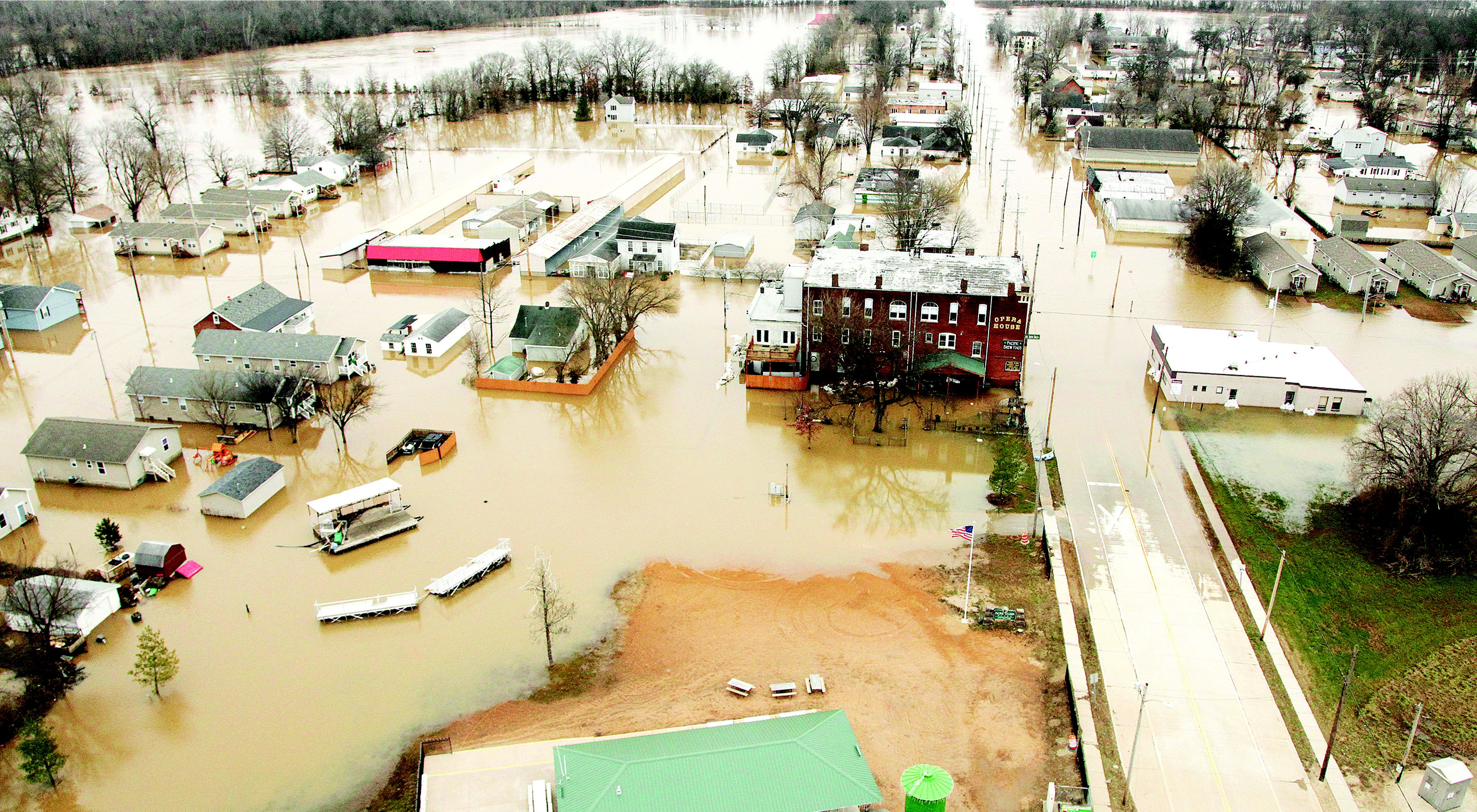
Restoring floodplains is a key strategy for communities grappling with annual flooding along the Mississippi River from Iowa to Missouri to Louisiana.
Every year, as snow melts and spring showers form, water rushes down the Mississippi River, a 2,350-mile liquid highway that stretches from Minnesota to the Gulf of Mexico.
When the river floods, spilling over its banks and inundating adjacent land, it can wreak havoc on communities. But those swirling flood waters are also part of a naturally-occurring process that cues fish to spawn and nourishes floodplain forests that provide wildlife habitat and improve water quality.
The trick is keeping things balanced, so nature can do its work while farmers and other industries do theirs, especially as the climate changes and flooding becomes more intense.
“We’ve changed the landscape so much over the last 200 years,” says Rebecca Smith, director of the Nature Conservancy’s Great Plains Division. “That’s allowed us to have amazing production in crops that feed the world, but it’s been at the expense of making room for the river.”
Quote: Rebecca Smith
“We’ve changed the landscape so much over the last 200 years. That’s allowed us to have amazing production in crops that feed the world, but it’s been at the expense of making room for the river.”
Today, The Nature Conservancy is working with communities up and down the Mississippi to find innovative solutions that are good for farming, good for people and good for the environment.
“The Nature Conservancy brings the perspective of nature to the table, the consideration of strong science as part of the equation and the recognition that we want people and nature to thrive,” says Smith.

The solutions aren’t the same everywhere. But many of the themes are similar:
- More floodplains to absorb flooding, take up excess nutrients swept downstream with runoff and provide wildlife habitat
- Farming practices that keep more soil on farms
- More coordinated governance among those who rely on the river
Take a look at what’s happening in three states to get an idea of the work.
Louisiana
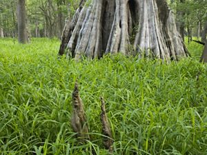
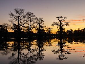
Deep in the Atchafalaya River Basin of Louisiana, a million acres of wetlands provide critical habitat for species including alligators, black bear and more than 250 kinds of birds.
“It’s a place where people live off the land. We love that culture, the tie to place—it’s the heartbeat of an American culture tied to the wetlands,” says Keith Ouchley, state director of The Nature Conservancy in Louisiana.
Here, Nature Conservancy experts are working to ensure the natural benefits of flooding by protecting existing floodplain forests, planting new trees and restoring natural hydrology wherever they can.
“We call the floodplain forests the kidneys of the Mississippi,” says Bryan Piazza, director of freshwater and marine science for The Nature Conservancy in Louisiana.
Quote: Bryan Piazza
“We call the floodplain forests the kidneys of the Mississippi.”
Historically, the Mississippi River’s floodplain covered about 24 million acres, much of it in Louisiana, and large portions of it flooded annually. That terrain served as spawning grounds for fish and a nursery for their offspring, and received sediment carried down the river. “It was the Amazon of North America, this amazing floodplain covered by water,” Ouchley says.
Today, more than 80 percent of the trees in that once massive forest have been cleared, and human engineering over the past two centuries has diverted water away from the wetlands, disrupting the natural flooding patterns. Canals cut east-to-west through the swamps to transport logs, equipment and oil and gas products now trap and stagnate water and stop the natural north-to-south flow.
“We get mini-dead zones that kill fish, stunt tree growth and create poor conditions for spawning,” Piazza says.

Quote: Bryan Piazza
“We get mini-dead zones that kill fish, stunt tree growth and create poor conditions for spawning,”
In 2017 the Nature Conservancy purchased 5,359 acres in the Atchafalaya Basin. Today it’s preparing to shave the tops off sections of canal levies there and cut notches in banks to allow floodwaters to once again flow through the wetlands. “We’re doing this in bayous that have closed up, trying to get flow from north to south and increasing the number of days that water can slowly move across those floodplains,” Piazza says.
The Nature Conservancy’s first project will make conditions better for trees and wildlife on about 5,000 acres, but officials say the opportunity to do this type of restoration exists across more than 100,000 acres in the Atchafalaya Basin.
“Trees help clean the water, take out excess nutrients (like phosphorus and nitrogen from fertilizers), slow down sediment and create wildlife habitat,” says Piazza.
One beneficiary of this work? Crawfish, a favorite wild crop that draws families and friends together each spring. The thumb-sized crustaceans live in swamps and bayous, and rely on detritus delivered by annual flooding for food. Fisherman harvest millions of pounds from the Atchafalaya Basin every year, and that catch winds up bubbling alongside potatoes and corn in backyard boiling pots.

Iowa
In Iowa, flooding occurs throughout the watershed of the Mississippi River each spring and summer. And it’s not just the Mississippi that floods. Tributaries of the great river, including the Des Moines River, the Cedar River and the Iowa River—plus other small streams—overspill their banks, sometimes inundating homes or farm fields, where the state’s vast crops of corn and soybeans grow.
That’s why the Nature Conservancy is working with agricultural partners to promote in-field practices such as prairie strips (sections of native prairie vegetation planted within crop fields to slow runoff) and cover crops (planted during the off season to hold soil in place and break up dirt compacted by tractor traffic). Farmers now plant about 2 percent of the state’s farm fields with crops like winter rye, radishes and turnips each winter, and The Nature Conservancy wants to boost that number.
“Not only will it slow water runoff, it will improve water quality by tying up nutrients found in fertilizers,” says Susanne Hickey, director of conservation programs for The Nature Conservancy in Iowa.
Quote: Susanne Hickey,
“Not only will it slow water runoff, it will improve water quality by tying up nutrients found in fertilizers.”
Coupled with practices like not tilling or only partially tilling their fields, farmers are improving soil health by providing more organic material for their crops and creating an absorbent, sponge-like cover that holds in moisture during drier months.
“(Our) program is designed to get farmers to try these best management practices, so when that rain event happens, we’ll have less runoff, and that runoff isn’t going to carry excess fertilizer downstream,” Hickey says. “That means we get cleaner water and reduced flood peaks and reduced potential for high water.”

In some watersheds around the state, The Nature Conservancy is helping secure funding to restore small oxbows, the u-shaped sections of meandering river cut off from the main flow. The small restored lakes provide rich habitat for native wildlife and fish, including the federally endangered Topeka shiner minnow. They also improve water quality and serve as sponges that absorb excess flood waters.
“These oxbows can remove anywhere from 42 to 90 percent of nitrogen that’s carried in from farm fields,” Hickey says.
A two-year project finished in 2019 restored 38 oxbows and wetland projects in the Des Moines River and Cedar River watersheds, and more than 400 potential sites have been identified in the Boone River watershed alone, meaning many opportunities exist throughout the state.
Missouri
Flooding affects almost every county in Missouri, periodically inundating homes and closing interstates not just along the Mississippi River, but along its tributaries.
The Nature Conservancy is finding ways to use nature—and benefit the environment—as it addresses that flood risk.
“We’re promoting nature-based solutions and floodplain restoration in rural and urban areas, or buyouts where you get people out of harm’s way and conserve floodplain land so it’s not developed,” says Barbara Charry, Floodplains and Nature-Based Solutions Strategy Manager for The Nature Conservancy in Missouri.
Quote: Barbara Charry
“We’re promoting nature-based solutions and floodplain restoration in rural and urban areas, or buyouts where you get people out of harm’s way and conserve floodplain land so it’s not developed,”
Much of that work is focused along the Meramec River, a 220-mile tributary of the Mississippi River and one of the longest free-flowing rivers in the country, and its 2.5-million-acre river basin. There, the Nature Conservancy has provided technical support to communities and developed an online tool that helps them determine cost benefits of floodplain restoration and find funding to support it.
“In areas where turf grass grows or the land is all in agriculture, we can plant trees to create a floodplain forest that helps prevent erosion,” Charry says. “Or we can restore parkland that’s just mowed grass to floodplain function.”

Turf grass acts like concrete—water hits it and slides right off, Charry says, but vegetation and trees slow down rushing water and decrease runoff. Engineers can design bio-retention ponds—depressions scraped out of the land—to hold some of the runoff from flooding, too.
“That helps sediment and nutrients settle out in floodplains, and helps with cleaning water and creating wildlife habitat for a wide range of species,” Charry says.
Instead of covering lots in frequently flooded areas acquired through voluntary home buyouts with grass that has to be mowed and maintained, the Nature Conservancy advises communities to restore that land to natural floodplain habitat by planting native trees.

“Riparian and floodplain habitat is some of the richest in world, providing food for invertebrates and fish that become food for mammals and birds,” Charry says.
In the future, the Nature Conservancy hopes to do more floodplain restoration demonstrations.
“Rivers are meant to flood, and by embracing that and using natural solutions, we get many benefits,” Charry says. “We get resilience, we get wildlife habitat, clean water and flood risk reduction. And we know green spaces are important resources for communities.”
More Flood Solutions

Nature's Potential to Help Reduce Flood Risks
Nature-based solutions—such as reconnecting floodplains to give rivers more room during floods or restoring reefs, marshes or dunes that can protect coastal communities during storms—can also help improve water quality, provide prime wildlife habitat, enhance recreational opportunities, and produce related economic and social benefits.
Tool Protects Floodplains in the Mississippi River Basin
Our new interactive Floodplain Prioritization Tool helps stakeholders make decisions related to water quality, wildlife habitat and flooding in the Mississippi River.
Sustainable Rivers Program
The Nature Conservancy and the U.S. Army Corps of Engineers are finding new ways to strike a sustainable balance in how people use and protect the many benefits that rivers provide.