Rivers of the Upper Ohio River Basin
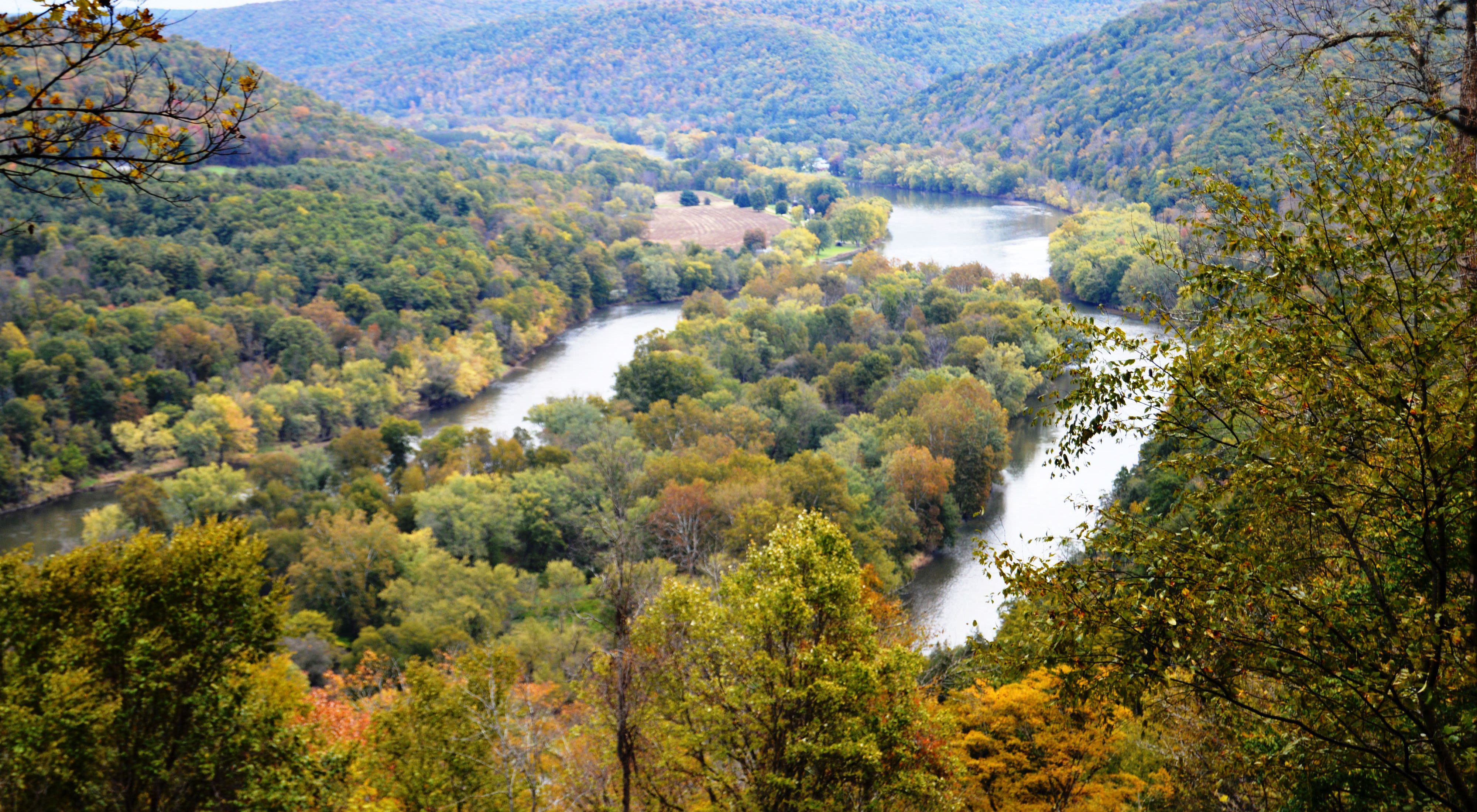
The Allegheny and Youghiogheny Rivers combine to form the most biologically diverse watershed in Pennsylvania.
Originating upstream of Pittsburgh are the Wild and Scenic Allegheny and Youghiogheny rivers of the Upper Ohio River Basin. With headwaters in Pennsylvania’s only national forest, the Allegheny has the highest diversity of freshwater mussels in Pennsylvania and provides drinking water to Pittsburgh. The Youghiogheny flows north for over 130 miles through a series of steep drops where exposed bedrock and boulders support unique floodplain ecosystems. It’s here where adventure-seeking rafters and kayakers navigate the river’s challenging waters.
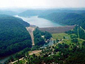
Major dams, managed by the Pittsburgh District of the U.S. Army Corps of Engineers, have changed how these rivers flow. With these dams in place, high flows, low flows, water temperatures and the amount of sediment and organic matter transported by rivers can all change. Climate change forecasts will further change river flows—we will monitor and study the effects of a changing climate on these rivers.
Just 2% of our nation’s three million miles of rivers and streams are still free-flowing and undeveloped. The survival of our freshwater systems hinges on our ability to reduce the impacts of dams on nature.
The Nature Conservancy is advancing an innovative partnership with the Pittsburgh District U.S. Army Corps of Engineers that evaluates the impacts of these dams and identifies solutions for clean water, power and reduced flood risk while taking into account the needs of fish and wildlife in the river.
Quote: Colonel John P. Lloyd

We must consider that aging infrastructure not only refers to the physical age and condition of our facilities but also to the historical purposes for which they were built.
The Sustainable Rivers Project
For much of the 20th century, the United States built thousands of large dams and other water projects to meet the nation’s growing need for water, food, flood protection, hydropower and navigation. But since their construction 40-80 years ago, the operations of very few public dams have been updated to address current needs, changing climatic conditions, or the maintenance of this aging infrastructure.
The Sustainable Rivers Project (SRP) is a national partnership between TNC and the U.S. Army Corps of Engineers, the largest water manager and hydropower producer in the nation, that provides a unique opportunity to shape the future of how water infrastructure and our rivers are management.
The SRP enables practitioners take a fresh look at water infrastructure—evaluating current water quality, flood risk and power generation needs, while identifying the unintended ecological impacts of dam operations, and ultimately advancing opportunities to make rivers stronger, more resilient and managed to meet the rising demands for clean water and the uncertain impacts of a changing climate.
Through the SRP, TNC and the Corps are assembling state-of-the-art research on the rivers’ unique flow requirements and then creating dam operating plans that achieve environmental flows—scientific prescriptions for the timing and level of water flow that must occur downstream of dams in order to revive and sustain critical ecological functions and habitat for species.


Taking Action
Through the Sustainable Rivers Project, TNC is working with the Pittsburgh District of the U.S. Army Corps of Engineers to improve operation of the dams and reservoirs on the Allegheny and Youghiogheny rivers to more closely mimic the natural flows of these waters. Our goal is to ensure the right amount of water, at the right times of year, for all the plants and animals that depend on it, while still meeting the flood control, recreation, and water quality purposes for which this infrastructure was built.
In 2018, after years of study, TNC partnered with the Corps and the Western Pennsylvania Conservancy on a test release from the Kinzua Dam, on the Allegheny River, one of the largest U.S. dams east of the Mississippi River. Using sonar and other mapping tools, scientists measured and recorded the shape of the river bottom. This measurement tool allows scientists to better understand and evaluate underwater conditions for fish and mussel habitat under different flow conditions. By translating science into action, we can identify opportunities to manage dams in ways that support our need for clean water, renewable energy and healthy rivers.
Stay in Touch
Subscribe to Nature News, our monthly e-newsletter. Get the latest news and updates about our conservation efforts both locally and around the world, delivered straight to your inbox.
Pennsylvania Rivers
Sustainable Rivers Program
The Nature Conservancy and the U.S. Army Corps of Engineers are finding new ways to strike a sustainable balance in how people use and protect the many benefits that rivers provide.
Cool Green Science
The Nature Conservancy and the U.S. Army Corps of Engineers expand the successful Sustainable Rivers Program.

Taking a Restoration Road Trip
Learn about various preserves, projects and happenings across PA & DE.